
About

Geography of Anyang
In Anyang, there is Surisan Mountain in the southwest, Gwanaksan Mountain and Samseongsan Mountain in the north, and an oval basin in its center.
Anyang is located southwest of Seoul and is a city developed in the upper-middle reaches of the Anyangcheon Stream, a tributary of the Hangang River. Agricultural and industry development took place along the Anyangcheon Stream, and the waters of the Anyangcheon Stream was used for agricultural and industrial use for the sustenance of the city residents.
Anyang has played an important role as a transportation hub due to the industrial development that far outpaced other cities and roads that extend towards all directions.
Geographical Characteristics
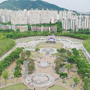
Anyang accounts for 0.05% of the total land area of the Republic of Korea. In terms of administrative division, the city borders Gwacheon-si and Uiwang-si to the east, Gwangmyeong-si and Siheung-si to the west, and Seoul's Geumcheon-gu and Gwanak-gu to the north. Between 1989 and 1995, the Pyeongchon area, which used to be a wide plain, was developed into a residential area, creating today's Pyeongchon New Town.

Climate
Anyang has four distinctive seasons, and its winters are usually cold and dry, while its summers are generally hot and humid.
The average annual temperature is 12.3°C, which has risen by about 1°C compared to the past.
Average annual precipitation is 1,198 mm, which falls intensively between June and August.
The rainfall that occurs during these months’ accounts for 66% of the total precipitation for the city.
The average annual temperature is 12.3°C, which has risen by about 1°C compared to the past.
Average annual precipitation is 1,198 mm, which falls intensively between June and August.
The rainfall that occurs during these months’ accounts for 66% of the total precipitation for the city.
Administrative Divisions
| District (gu) | District (gu) | Administrative dongs |
|---|---|---|
| Manan | Anyang | Anyang 1 ~ 9 dongs |
| Seoksu | Seoksu 1 ~ 3 dongs | |
| Bakdal | Bakdal 1 ~ 2 dongs | |
| Dongan | Bisan | Bisan 1 ~ 3 dongs, Buheung dong, Dalan dong |
| Gwanyang | Gwanyang 1-dong, Gwanyang 2-dong, Burim dong | |
| Pyeongchon | Pyeongchon dong, Pyeongan dong, Gwiin dong | |
| Hogye | Hogye 1 ~ 3 dongs, Beomgye dong, Shinchon dong, Galsan dong |